


The Cotswold Way
After our very successful Dalesway trip with friends last year, this year we decided to embark on the Cotswold Way, walking from Chipping Campden to Bath, a distance of 102 miles. The walk can be completed in either direction, we opted for north to south as it gave us the opportunity of a few days in the beautiful city of Bath at the end. The Cotswold area was designated a landscape of Outstanding Natural Beauty in 1966, it is 83% farmland, and has been inhabited by people for over 6,000 years, with many ancient relics to view along the way. It has beautiful towns and villages to visit and tremendous views from the natural escarpments. There are many beautiful beech and yew woodlands and it is linked by a huge Rights of Way network.
We pre-booked all accommodation, the area being a very popular tourist destination and as especially in the later stages of the walk there is a dearth of rooms. On this occasion we pre-booked our evening meals, as our walk just happened to coincide with the end of some covid restrictions so we thought the pubs might be pretty busy.
After studying the route, we decided to attempt the route over 8 days, some walkers take less time, some more. The route has more elevation than we had imagined, we averaged 1500 feet (450m) a day. We wanted to make the walk enjoyable for everyone in our group, as well as leaving some time to explore the various points of interest along the way. The route is said to be the best signed of the National Trails across England with frequent sign-posts, either with places names or an acorn on to show the way. We still took a map and a guide book, as I think it is interesting to read about the places too.
We booked the train tickets in advance on the train splitter website, which works out the cheapest journey. Catching the train from our home in Manchester to Stoke-On-Trent, Oxford and arriving in Moreton- in-Marsh 4 hours later. We had pre-booked a mini bus from Moreton for the 6-mile journey to our destination for today of Chipping Campden. Alternatively, it would have been a beautiful walk across the fields. But for this trip we had brought a suitcase which we had shipped each day by Sherpa transport, and just carrying day sacks with us.
After checking into the Volunteer Inn, we did our usual recce around, to find the start of the walk, members of our group took advantage of the lovely pubs too. Chipping Campden is a beautiful old Cotswolds village, make some time to look round. We had pre-booked dinner in the Volunteer Inn, which has a recommended Indian Restaurant.
https://www.trainsplit.com
www.moretoninmarshtaxis.com
https://www.thevolunteerinn.net
Cotswold Way Day 1 Chipping Campden to Winchcombe
In anticipation of a fairly long day of 16 miles we had breakfast relatively early at 7.30am (ordered the night before). Leaving our suitcase in reception for Sherpa transport to collect-as we did every morning-we walked to the very handy Co-op Store opposite the start of the walk. Other small shops are available. As a sunny day was anticipated we wore shorts (as we did every day regardless of the weather). We were all very excited for the start of the trip. The official start/or finish depending which way you walk, is marked by a plaque by the old Market Hall and War Memorial, and a national trail sign set in the ground, which lists all the places to be visited. The Market Hall was built in 1627 for the sale of local produce.
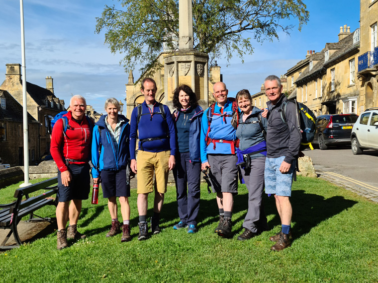
Leaving at 8.45am we briefly re-traced our footsteps, then turned right by St Catherines Church, then up Hoo Lane, continuing up a sandy track, passing beautiful houses, one with a blue plaque for the author Graham Greene, whilst watching swallows, swifts and house martins. We crossed the main road, and headed for Dovers Hill. This gave us the first of many views of the trip, this time over the Vale of Evesham and the Malvern Hills in the distance. Dover’s Hill (230m) was named after Robert Dover, who organised his first Olympic Games in 1612, with leapfrog, wrestling, shin-kicking etc, which lasted until 1852. It was revived in 1951 and takes place annually on May Bank Holiday. (We must return!!)
We continued along Mile Drive, through beautiful countryside, arriving on the A44 at Fish Hill near a topograph. There is a free public toilet block in the car park. (10.15am) We crossed the road besides an old limestone quarry. Limestone is used for building the beautiful yellow-stone cottages and dry-stone walls, for which the area is famous. The path continued upward through an Anglo-Saxon burial ground-spot the mounds and hollows, then going left at a gate.

Broadway Tower was designed by James Wyatt in 1798. To enter the area, it is necessary to obtain a ticket from the office which is somewhere past the tower. We did not do this, our path continued past the right-hand side of the tower, downhill to the stunning village of Broadway. (11.20am). We stopped for a coffee at Number 32 cafe, pleased to have got the first 6 miles completed. In Broadway there are many shops, hotels, and restaurants, and it is an extremely popular village-well-deserved in our opinion. Stagecoaches used to stop here to change horses before ascending Fish Hill. We headed straight through the village before taking a path to the left down Church Street, then right across the fields once more, before turning right through a muddy farmyard. It is a beautiful walk, with great views and we could see the rain sweeping in to our west.
The rain stayed away from us. We arrived in Stanton (1.30pm) and ate our lunch on the well-kept village green. Stanton is an archetypical Cotswold village and possibly the most beautiful along our walk-truly stunning, with many thatched buildings. Spot the thatch animals on the roofs too. Please note if aiming for the village pub The Mount Inn, it is not on the track but turn right when first arriving in the village. We continued through further beautiful countryside with fields of cows and sheep, following lines of trees stretching into the distance.
We passed the fabulous Stanway House, and a C12th church, both with ornate carving. The watermill is open to the public on specified days. We continued for a couple of miles, through Wood Stanway across undulating fields with fine views, before arriving at one of the first of many iron age hill forts, complete with ditches and ramparts, set on a scarp slope at Beckbury Hill (3.45pm).
Check out the tower to Thomas Cromwell where allegedly he sat to watch the destruction of Hailes Abbey, following the Dissolution of the Monasteries in 1539 as ordered by Henry V111. Hailes Abbey was originally founded in 1246 and for 300 years received thousands of pilgrims. It is now open to the public, being owned and maintained by English Heritage. Hayles Fruit Farm nearby has a farm shop and tea room, but we needed to keep moving.
We could see black clouds approaching and reached for our new waterproofs, shortly before the heavy rain and hail arrived. We spent the last hour of the walk in a storm, as well as wading through mud. Unfortunately, this seemed to be the pattern for the whole trip. We arrived in The White Hart, Winchcombe at 5.15pm dripping on the stone floor. We ate later in their restaurant where a good selection of meals-chicken, fish pie, burger etc were presented. Winchcombe is a sizeable town, again with many buildings of interest, but not quite as pretty as the previous places visited. It has a large co-op, bakery, sandwich shop etc, which gave us many options on purchases for lunch. If spending a day here, there are many local trails and Sudeley Castle to visit too.
It had been a fairly long day, mostly in glorious sunshine, but then followed by torrential rain-lucky I had my umbrella with me as usual. We had visited glorious Cotswolds villages, and resplendent countryside. We all had an early night in anticipation of another long day.
Winchcombe was recently in the news due to a meteorite landing on someone's drive. The meteorite as old as the solar system ( 4.5 billion years ), weighed 103 grams and is now in the Natural History Museum in London.
Distance 18.5miles (29km)
Duration of Walk 8.23 hours
Average pace of walk 27 minutes per mile
Steps 42796
Elevation 2137 feet (650m)
https://number32broadway.co.uk
https://whitehartwinchcombe.co.uk

Cotswold Way Day 2 Winchcombe to Cheltenham
Everyone had felt a bit tired the previous night after the first day’s walk, but they were all up refreshed, ready to have breakfast at 7.30am. After visiting the small co-op and bakery to purchase lunch, we set off with the weather looking good for today's walk. Leaving the White Hart Inn at 9.15am, we turned left through the village past the old cross, down Vineyard Street with Victorian Almshouses, over the river and out of town, heading towards the beautifully sited village cricket club, continuing uphill, before arriving at the wonderful Belas Knap Burial Chamber. This is owned by English Heritage and is free to enter.
Belas Knap is one of the finest historic sites on the walk, and 4m high at its highest point. It is 54m long, 18m wide and dates from around 3,000 BC, before later being used by the Saxons. At least 38 burials have been found in the 4 chambers, some with Roman coins. The views are sublime, and it is amazing to think how long this area has been settled for.
After Belas Knap the path heads west, then north, with views looking back to Winchcombe (11.15am), we did feel that we had come round 3 sides of a square! But that does seem to be the nature of this walk, never seeming to take the most direct route, probably the most scenic instead. Continuing we circumnavigated the imposing Postlip Hall, check out the wayside spring found on the left-hand side of the boundary wall, before climbing again to reach the top of Cleeve Common. The common is a site of special scientific interest. It contains the highest land of the Cotswold escarpment at 330m and a golf course. The weather changed from beautiful sunny morning to rain, we called into the very conveniently located Cleeve Hill Golf Course café, for a welcome drink and snack whilst watching the heavy rain fall. (6 miles) This is the only food stop available on this day.
Fortunately for us the storm passed, and we left (12.30pm), with fabulous views to the Brecon Beacons and Mendip Hills in the west. There are many paths here, but we followed the edge of the escarpment visiting the trig-point at 317m with another topograph. Eventually Cheltenham came into view, but the weather worsened in the west. We could see heavy rain falling in the distance, together with lightning striking some of the small hills. It was fairly scary to be at the top of the escarpment, and wondered if we should leave. But we continued on our path, keeping an eye on the distant storm.
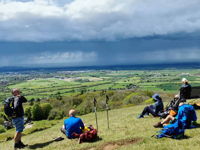
We were very lucky and the storm did not reach us, and stalled over Cheltenham instead, we only had a small shower of rain. In the distance we could hear and see the smoke from the heritage Gloucestershire Warwickshire railway line with 10 miles of track through the countryside.
This stage of the Cotswold way ends by Dowdeswell reservoir on the A40 London Road. I could not find any accommodation at this point, instead we had booked the London Inn in Cheltenham. In our guide book, it mentions bed and breakfast at the Koloshi curry house, this appears now to be a restaurant with no accommodation. We debated whether to follow the true Cotswold Way path and walk 1.5 miles along the main road to our pub. Instead, we opted to turn right through the woods, along a footpath which would bring us out on the A40 but closer to our destination. This turned out to take a long time, the path disappearing at times, and also having many stiles and lots of mud. Eventually we emerged on the road, turning right and arriving at our destination at 3.45pm.
The sun had re-appeared, so we sat out in the lovely beer garden. We ate in the pub's restaurant, where large portions of food are served. Alternatively, there are plenty of eateries in the local vicinity. Otherwise, a bus or taxi could be taken the 1.5 miles to Cheltenham city centre, which is really worth checking out having many fineGeorgian buildings.
We all loved the day, with the thunderstorm creating lots of excitement. Belas Knap burial chamber is really worth visiting. We were happy to have walked 27 miles over the first 2 days.
https://en.wikipedia.org/wiki/Belas_Knap
Cotswold Way Café | Relish Group (relish-group.co.uk)
STANWAY - Stanway House & Fountain (stanwayfountain.co.uk)
London Inn, Cheltenham | Homepage (thelondoninncotswolds.com)
Distance 13.12 miles (21km)
Duration of Walk 6 hours 45 mins
Average pace of walk 31 mins a mile
Steps 32337
Elevation 1463 feet (445m)
Cotswold Way Day 3 Cheltenham to Birdlip
After debating whether to return up a very steep muddy hill to where we had left the Cotswold Way the day before, we decided this was not a good plan. I follow Wainwright's theory of the walk is between two places, and the actual route does not need to be followed, but others may disagree. After breakfast we left shortly after 9am, turning right out of the pub following the pavement along the busy A40 to re-join the Cotswold Way just beyond the Koloshi Indian restaurant at 9.45am. On the way we passed many food stores, and a most interesting Dunkertons cider shop, perhaps one to remember for next time we are here.

We were pleased to leave the traffic, and headed uphill passing a small car park, then through the woods to achieve the top of the escarpment once more, the great views continued back to where we had walked the previous day over Cheltenham and the hills beyond. We then dropped down to a path that runs parallel to the A436, turning right on the roundabout then following the path over Hartley Hill. We enjoyed the area of Leckhampton Hill 294m with a topograph, another iron age hill fort, and an old quarry which created the rocky outcrop of Devil’s Finger. We had left that morning rather ambitiously wearing our shorts, but by now it was very windy and wet so all waterproofs were worn together with winter hats and gloves. Oh, to be in England in Mid-May, with again the rain sweeping in from the west.
We passed National Star College bistro, unfortunately it was closed (12.45pm). We ate our lunch in the woods, with the trees providing some shelter from the rain and wind. We continued to Crickley Hill Country park- with a café, take-out coffee and free toilets, which is a viewing location, but the only view we had was rain sweeping across towards us. On another day we may have stopped, but we pressed on also passing the Air Balloon pub having decided to skip coffee or pub breaks and just arrive at our hotel. We arrived very wet and cold at 3pm, so happy to arrive given the very inclement weather.
We had a delicious dinner in the pub's restaurant- as a “Greene King” chain of pubs there was certainly plenty of choice. We were also able to dry out all our kit in the hotel rooms. We were intending to have a walk of the village of Birdlip, but it was far too wet for that. It continued to pour in rain all night, adding to the already waterlogged paths.
Distance 12.8 miles (20.5km)
Duration of Walk 6 hours
Average pace of walk 28 minutes per miles
Steps 30,000
Elevation 1654feet (504m)
https://www.nationaltrust.org.uk/crickley-hill
https://royal-george-hotel-gloucester.at-hotels.com/en
Cotswold Way Day 4 Birdlip to Selsley
Exciting day for some today as it is change over day for some of our walkers. Three leaving and a couple arriving later. When arranging the trip, we had spent some time debating this leg, as it could end either at King’s Stanley/Middleyard or Selsley. The path splits at the Stroudwater Canal, before merging later at Penn Hill. We opted for the walk along the canal to Selsley.
We knew it was going to be quite a long day of about 18 miles. As usual the problems with walking in the UK, are the temptation to have the cooked breakfast which is usually included in the hotel price, but is time consuming, and secondly the lack of accommodation along the route. We have walked extensively in Spain, and did not have either of these problems, but perhaps we were lucky.
We were hoping that the weather would be slightly better than yesterday, but with more 40 mile per hour winds forecast, it didn’t look too promising.
After yet another delicious breakfast, we left the Royal George Hotel at 9am, not visiting the village, going straight down the very muddy path, through more beautiful woods, complete with wild garlic and bird song. The views were splendid with Gloucester Cathedral and the Severn Valley. We arrived at the very famous Cooper's Hill at 10.15am. Each year on Spring Bank Holiday Monday, the festival of cheese-rolling takes place on this very steep slope. Contestants plunge down the slope in pursuit of a cheese, the winner gets a 3kg Double Gloucester. Check out this event on YouTube, each year there are quite understandable injuries. Walking through more pretty woods, we crossed the very busy A46, arriving at Painswick Beacon at 11.30am, and golf course. Painswick Beacon at 283m was settled as an Iron Age Fort, used in 1052 by a Saxon leader, then in 1643 by Royalist forces during the Civil War. Given the location we could see why.
We arrived in the village of Painswick at noon, the weather had taken a turn for the worse. This is another very pretty village, and well worth a visit, with many information boards, and recorded in the Domesday Book in 1086. At the height of the cloth trade, there were 25 mills, making it prosperous and providing funds for the many elegant properties still found. This could also be an alternative end of today's leg, with accommodation available. We went to St Michael’s Café, drying off some kit on the radiators. The food was delicious, if visiting make sure you see the original well in the toilet.
We would have liked to linger longer as it was still raining and windy, but time was ticking by. We left at 1pm, passing the church and lych-gate. We made our way across more fields discovering a stone saying Bath 55 miles and 47 miles to Chipping Campden-exciting. Passing the Edgemoor Inn, again careful to cross the road, and pick up the correct sign.
The afternoon walk continues through Maitland Wood (1.50pm), with views to the Bristol Channel at Haresfield Beacon, (2.45pm) on which there was once another hill fort and Roman settlement. The impressive views continued with another Topography point (3.30pm), then on to Standish Wood.
After all the woods the path descends towards Stroud, with fine views of the town, passing vineyards-fairly unusual in England. We crossed the canal and followed the south bank for a few miles. The canal was opened in 1779, linking the busy textile centre of Stroud 8 miles to the navigable River Severn at Upper Framilode with 12 locks. Coal came in from Shropshire, and woollen products were made in the many mills. The canal was shut in 1954 due to a decline in both the woollen industry and the canal trade. Check-out Ryeford Double Lock and cottage built in 1784. Over the past ten years much restoration work has been carried out, re-opening the canal to boats, after many years of it being disused. It was beautiful to
see so many birds living on it, both banks have restored buildings and new developments-these being in keeping with the old. It had been a cold afternoon, but fortunately drier than previously.

Leaving the canal, we crossed the busy A419 on a pelican crossing, and walked up the final hill of the day, very happy to reach our destination Bell Inn Selsley at 5.40pm. We later ate dinner in the pub, being Friday night, it was busy, and we had fortunately booked in advance.
Distance 18.5 miles (29.5km)
Duration of Walk 9.1 hours
Average pace of walk 38 min per mile
Steps 42836
Elevation 1378feet (420m)
Cooper's Hill Cheese-Rolling and Wake - Wikipedia
Cotswold Way Day 5 Selsley to Dursley
We had not booked breakfast at the Bell Inn so we walked down the hill for ten minutes to Sainsbury Supermarket, buying croissants and some food for lunch, as there are no facilities on this stage. We bought coffee from Costa coffee at the Esso garage nearby. As this was one of our shorter stages, we took our time and hoped for better weather than the previous days.
Walking back up the hill we joined the main path at 9.15am, walked along the road, arriving at Selsley All Saints Church with fabulous views over the River Severn. There was high grey cloud, we hoped for sun, and no rain. Passing the war memorial, we were soon up on the escarpment once more, with great views. In Penn Wood the alternative path coming from Kings Stanley joins (10.15am). We followed the path south through Coaley Wood, before reaching Nympsfield Long Barrow. This dates from around 2800BC, and was used for burials. Skeletons, flint arrowheads, and pottery have been found within. The dry stone wall now seen is a reconstruction, checkout the information boards.
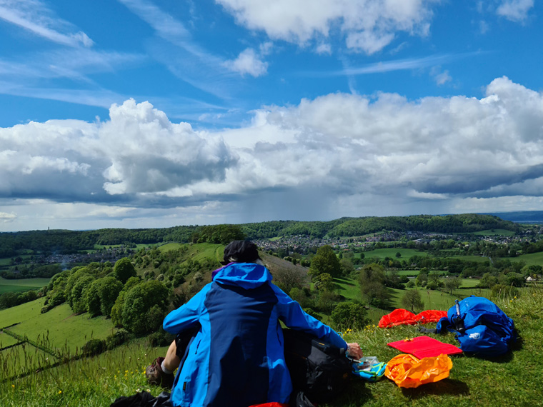
We ate on the useful picnic benches at the viewpoint, whilst watching the paragliders catching the thermals, with more great views. Passing another topograph 237m, then through a quarry. We arrived at a road junction B4066, from here we had intended to go to Hetty Pegler’s Tump-another burial ground. But did not realise that we had to walk down the road to reach it. Unfortunately, we crossed the road and continued down through the woods, and by the time we realised we did not want to re-trace our steps. The path re-joins the B4066, and we did consider walking back along the road, but it was far too busy with no pavement. Instead, we opted to visit Uley Bury Hill Fort which dates from the Iron Age with ditch and rampart defences. It has never been excavated, though Roman coins have been discovered. We circumnavigated the 30 acres, and once the heavy rain cleared sat on top of the 90m scarp face and ate our lunch, overlooking the next stage of the path.
There is an obvious path which re-joins the Cotswold Way on a country lane, then we proceeded up Cam Long Down, and Cam Peak (184m) again with extensive views. The plateau has strange undulations, which may have been an ancient settlement, terraces can be seen on the south-facing slopes. It was now very sunny once more, we went down through the woods, along a stream, through an extremely water-logged gate-prizes given to the best way to get through that! We arrived in Dursley at 3.30pm, again having had a day of very mixed weather.
Dursley was the most disappointing town on the whole walk. Other places were very beautiful ancient prosperous towns, originally based on mills and wool production. Dursley has maybe fallen on hard times, but the old Market House built in 1738 still remains. It had a very useful large Sainsbury store. We ate at where we were staying Ye Old Hotel Dursley, built in 1787 which served substantial good value meals, as we would say good walking food. There are very few places to eat in Dursley, there is an Italian restaurant which was booked up and a chip shop.
Distance 10.3milDursley was the most disappointing town on the whole walk. Other places were very beautiful ancient prosperous towns, originally based on mills and wool production. Dursley has maybe fallen on hard times, but the old Market House built in 1738 still remains. It had a very useful large Sainsbury store. We ate at where we were staying Ye Old Hotel Dursley, built in 1787 which served substantial good value meals, as we would say good walking food. There are very few places to eat in Dursley, there is an Italian restaurant which was booked up and a chip shop.
Distance 10.3miles (16.5 km)
Duration of Walk 6 hours 30 mins
Average pace of walk 37 mins per mile
Steps 31397
Elevation 1185 feet (390m)
Nympsfield Long Barrow - Wikipedia
YE OLD DURSLEY HOTEL - Updated 2021 Restaurant Reviews, Photos & Phone Number - Tripadvisor
Cotswold Way Day 6 Dursley to Hawkesbury Upton
Due to the inclement weather arriving later in the day, and breakfast not being included in the price, we decided to make an early start. We had visited Sainsbury's the night before, so had breakfast in our rooms before departing at 7.45am. We had checked with the landlord the night before and he explained how to leave via the fire escape, we did look very suspicious though!!

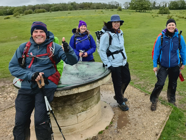
The path goes through the town turning right past The Old Spot Inn, up a steep road, through the wood, before emerging onto the Dursley golf course at 8.15am, then we turned right down a path. There is an alternative route straight across the golf course which would save a couple of miles, but we chose the more scenic route round Stinchcombe Hill. Continuing we came to a shelter with views to both Severn Crossings, the Malverns, Brecon Beacons and beyond, we reached another topograph and a stone bench at the top of Stinchcombe Hill 219m.
Continuing through woods, and across a large field, heading towards a tower on the hill. We arrived in the small village of North Nibley at 10.15am/5 miles, and headed past the open-air church service to the very welcoming North Nibley Café/Village Shop. We stopped for coffee and cake and bought some lovely cards. Continuing uphill once more, through the woods to the Tynedale Tower. This was built in 1866 and is 33m high, built to commemorate William Tynedale, a local resident who translated the Bible from Latin into English. He was later accused of heresy and burned at the stake in France in 1536. It is sometimes open to the public to climb up, sadly though not on this occasion. We continued along the scarp edge, passing through Brackenbury iron age fort. On the way down to Wotton, we passed a copse of trees which were planted in 1815 to commemorate the victory at Waterloo, and have been renewed twice, once in 1887 to commemorate the jubilee of Queen Victoria, then again in 1952.
We entered the village of Wotton-under-Edge (the farm in the wood) and bought some lunch. There are plenty of shops, pubs and places to stay and plenty of very interesting historic buildings and information boards. We were shown round the almshouses which were built in 1642, by some friendly locals. We continued, the path passing through the cemetery and we could see black clouds rolling in once more. We put on our waterproofs, as the wind blew and rain poured down. Fortunately, we found a thick area of forest to shelter in whilst we ate lunch (2pm). Continuing, the path was just a stream down through the woods, but at least our feet in walking boots were dry. It eventually stopped raining, the path crossing pleasantly undulating countryside. We passed another tower 36m high, this one built in 1846 to remember General Lord Robert Somerset who fought in the battle of Waterloo, before we turned left along the main road to Hawkesbury.
We were very happy to arrive at the Fox Inn, very wet. Dinner in the pub restaurant was delicious, with large portions provided, I had the carvery. Heavy rain was forecast to last all night, and for the next day, making the paths even muddier!
Distance 16.4 miles (26 Km)
Duration of Walk 8 hours 35 mins
Average pace of walk 39 mins per mile
Steps 38950
Elevation 1929 feet 590 m
Community Hub (northnibley.org.uk)
Home - The Fox Inn, Hawkesbury Upton (thefoxinnhawkesbury.com)

Cotswold Way Day 7 Hawkesbury to Wick
The weather is looking poor again, it had been so muddy underfoot the previous day, and following lots of overnight rain we could only anticipate even worse paths.
Breakfast at 8am served by John and Faye, was delicious. We left the cases to be picked up by Sherpa transport, put on our waterproofs and set out into the rain. We first visited the very useful Hawkesbury Stores, unfortunately it had been closed on the Sunday when we arrived. But it is a most useful shop selling everything! We bought some pasties, and sandwiches for lunch, souvenirs from our trip, and wine to have later with our dinner.
We left at 9.30am, and avoided the reputedly very wet Bath Lane by leaving the village along Highfield Lane. The weather was now dry but more rain was approaching, it was that cold our breath could be seen. Walking though woods complete with many garlic plants, we arrived at Horton House and Church. Horton House is spectacular, with a history dating back to 1185. It has been used as a filming location for both Wolf Hall and Poldark. It can be booked at holiday accommodation.
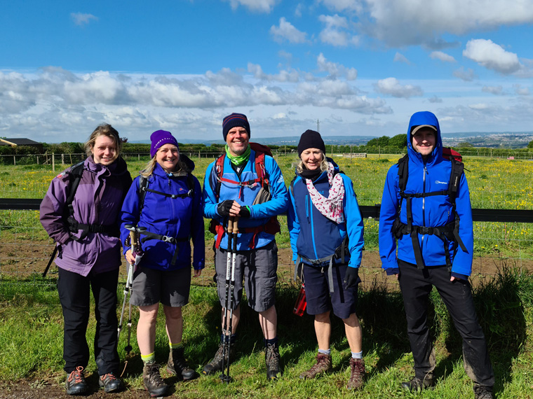
We met a young lady called Lucy Jarvis walking the Cotswolds Way from south to north. She had a very large pack, we stopped to chat and it turned out she is walking 1400 miles (2250km) from Lands' End to John O'Groats in aid of The Somerset Wetlands.Fundraiser by Lucy Jarvis : Walking The Length Of The UK For Rewilding (gofundme.com). We were so impressed with her, walking so far carrying so much kit, makes our walks pale into insignificance. Good luck Lucy ( Middle with big rucksack below ).
We continued down through the village of Horton, crossing fields to Little Sodbury, before arriving at Sodding Hill Fort (11.30am). This a large Iron age fort and one of the best examples in the Cotswolds, with double ramparts. Take care not to walk on them though. Take time to explore, as it is fascinating with the path going straight through the fort.
After 5 miles the village Old Sodbury was reached (1pm). The path goes through the Norman St John the Baptist churchyard, which has an amazing view over the Severn Valley. In Old Sodbury there is the Dog Inn, and a small shop at the Gulf petrol station if supplies are needed, both on the A432.The walk goes through Dodington Park, the house is not accessible, but the gardens are beautiful having been designed by Capability Brown. On the road is a sign saying Bath 17 miles by the Cotswold way-getting nearer.
We arrived in Tormarton at 1.10pm and sat on conveniently placed picnic benches outside the Majors Retreat pub, unfortunately shut on a Monday, when we were there.
Heading south through the village we crossed the M4 motorway bridge, through very pretty to fields, turning right. We crossed over yet another very busy main road A46 over more undulating fields with views to Bristol, before passing Dyrham House. At 3.30pm it started to rain once more. In Pennsylvania beside a Londis Shell petrol station (could be useful for supplies) we crossed the A46 again. We walked through the very pretty village of Cold Ashton complete with Manor House. To find our accommodation for the night Steve had fortunately phoned ahead to find the way. We turned right off Greenway Lane, towards Toghill Barn Farm, walking alongside the A420, before finding Toghill House farm to our left on Freezinghill Lane at 5pm. Happy to arrive, but once again very wet.
TogHill House Farm is a B and B not to be missed, and worth the effort to find it the owners being very friendly and helpful. The farmhouse historically was a resting place for pilgrims journeying from Malmesbury to Glastonbury Abbey. Then usage was changed to a pub, before becoming a farmhouse, with many animals kept too. The house has been re-built, but some old buildings remain including the old monks’ kitchen, brewhouse and 90 feet deep well. It is about 3 miles to the nearest town for dinner, but the landlady Laura very kindly let us have a take-out Chinese meal delivered which we ate in the dining room. Maybe the best meal of the trip!! We had carried our own wine for many miles too.
Distance 16.2 miles (26km)
Duration of Walk 8 hours 15 mins
Average pace of walk 30 mins per mile
Steps 36296
Elevation 1425 feet (435m)
Hawkesbury Stores ▷ Hawkesbury Upton, High Street (cylex-uk.co.uk)
Bed & Breakfast Wick BS30 Near Bath | Toghill House Farm

Cotswold Way Day 8 Wick to Bath
In anticipation of a shorter day than most we had a leisurely start, and for the first time the weather forecast was for sunshine, albeit a little cold, with no rain. Well, that was the forecast!! After possibly the finest breakfast of the trip, we left at 9.45am. The only way back to the Cotswold Way from Toghill House Farm is back down the main A420 road then across the fields by Toghill Barn Farm, taking roughly 15 minutes. It is worth the effort to reach here as Toghill House Farm B and B was exceptional, and there was a lack of anywhere else to stay. Re-joining the path (10.00am), we passed the Special Plants nursery to our right, before turning right going over a few fields, gaining height once more, with a bench situated at the highest point. The views ahead and behind are excellent.
After an hour we reached plaques informing us about the battle of Lansdown in 1643, with battlefield markers all around. The battle took place during the English Civil War between the Parliamentarians and the Royalists. There is a most impressive monument of Sir Breville Granville who was a royalist. During the battle he was hit on the head by a pole-axe, and later died. I presume this is where the expression poleaxed comes from. It is worth imagining the battle between the Royalists and the Parliamentarians, which resulted in the death of around 1500 people, and a Royalist victory.
Leaving the battlefield and taking care crossing the road, we headed towards the fire brigade complex station, then took a path to the right of this. Through the woods, and back into fields with views to Bristol and South Wales. We met some very interesting Cotswold Wardens who have spent 2 days a week for the previous 3 years re-building the dry-stone wall alongside the golf course. A very commendable way to spend one's time. At the end of the golf course, to the left of the path are the most unexpected sculptures by David Michael Morse. They are incredible of 2 horses and the grim reaper-don’t miss them. Continuing through a gate with more views, there was a cold wind and clouds were beginning to blow in. To the left just before Bath racecourse is Little Down Hill Fort. This is the last of the many Iron Age sites visited on this trip, and is found on the most westerly point of the walk.
At Prospect Stile (12.30pm), we reached a trig point with another topograph and bench, we ate a snack with the first great views over Bath and the hills beyond. We were happy as it is now down-hill all the way, and all very excited to be approaching Bath, but sad that the walk was finishing-always mixed feelings. We arrived on the outskirts of Bath just as it was starting to rain, and visited the excellent Western Café in Weston, to try to keep dry.
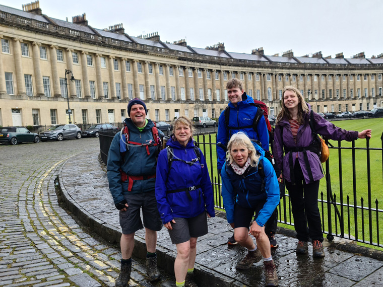
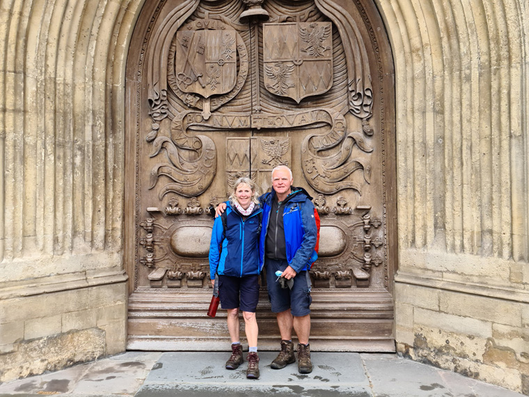
However, it continued to pour with rain all the way into Bath. We skipped some of the official path, taking the main road, then passing through the park, looking at the very famous Royal Crescents, The Circus, through the very pretty city, arriving at Bath Abbey at 3.10pm. We tried to take photos outside it, but the rain was torrential. We visited inside the Abbey, and its exhibition of slavery. We said our sad goodbyes to our friends at this point, as they were spending a few days in Bath. We had originally planned to do this too as it is a beautiful city and a fantastic place to finish a walk, but we had new adventures planned.

We had booked our train back to Manchester a few days previously, again using the train ticket splitter website. The train took 4.5 hours with 4 changes, but good value at £30.00 each, arriving back at our home in Manchester at 9.30pm. We also have a travel together card which gives us a third off most train fares.
To sum up this was a lovely walk across some very beautiful countryside, interspersed with pretty towns, villages, hill forts, battlefields and towers. We booked all accommodation and evening meals in advance, and arranged with Sherpa bag carrying services to transport our luggage. In hindsight most of the accommodation and restaurants were fairly quiet. But it would have been a risk not to book, especially walking as a group.
We would recommend this walk, but remember we covered an average 15 miles a day with an average of 1500 feet of ascent, and descent. We took 8 days to complete the 116 miles from Chipping Campden to Bath. But again, the walk can take as long or as short as you wish to make it.
Don’t forget, life is a series of great adventures – go and have some. Happy walking.
Distance 10.4 miles 16.5 km
Duration of Walk 5 hours 30 minutes
Average pace of walk 32 miles per mile
Steps 29887
Elevation 620 feet 190m
Bath | Cafe | Bistro | Bar (thewesternbistro.com)
Total Details of the walk
Total Mileage 116 miles 186km
Total Ascent 11,792 feet 3594m
Advice
We booked the accommodation in advance, and the evening meals. However, only the restaurant at The Blue Bell Selsley was actually full.
We booked Sherpa Transport to carry our bags in advance, they transport rucksacks, suitcases, and even camping equipment to the next destination. We always found them efficient, and never had a problem with them. All the accommodation could be booked through them too, saving time and effort. However, we like to book it ourselves as if there were any changes to our plans it may be easier to alter. We usually use Bookings.com to book, but occasionally we contact hotels on their website or phone. On most previous trips we have carried all our own kit, then the accommodation does not need to be booked in advance, but carrying less kit does make the walking more pleasurable.
If arriving by train book in advance for cheaper fares, we have a travel together card, getting a third-off the train fare, good value at £30 for the year. We used the train splitter website as it checks for the cheapest route, the downside of this maybe necessitating catching more trains and taking longer, but up to the individual.
An alternative start if carrying your own kit, would be to arrive then start walking straight away in Chipping Campden, walking the 6 miles and staying the first night in Broadway. Pros and cons, but if having the bag carried, Sherpa collect before 8.30am in the morning.
We worked out the route to be taken in advance, many stages have either long or short days, and accommodation in some areas seems to be lacking.
Study the maps in the " Cotswold Way A-Z for Walkers", or ordnance survey maps. By doing this, we sometimes formulated our own route, missing some road walking, or when the path was flooded taking country roads (which in general were very quiet.). We feel as long as we walked from Chipping Campden to Bath without motorised transport, then it is fine to deviate from the official path. At times, this is the only way to find places to stay as well.
Having done a couple of Caminos in Spain we are used to leaving at 7am and walking for a couple of hours before having coffee and toast for Breakfast. On the Cotswold Way, this is not an option as the price of breakfast is included with the room, and on many occasions, nowhere else to eat food. The downside of this being, departures are later than we would have liked, and too much food to eat before setting out!! Tempting as it is to eat so much, after a few days we and others did start requesting smaller portions.
There are very useful and interesting information boards all along the route, which we took photos of to read later. There is a string of iron age forts built all along the escarpment from Chipping Campden to Bath.
Items to take
On our previous trips – The Dalesway, and Coast to Coast we set out in perfect weather and got very wet. We decided to treat ourselves to new waterproof trousers-ensuring that they had zips/poppers down the side so they can be put on quickly without taking off our boots. We bought the Berghaus range from Go Outdoors, we were so pleased we had bought these as we would have got very wet and muddy. It rained every day, and was the 4th wettest May on record.
Wear boots, the only way to go. We wear Lowa boots, originally designed in Germany, and very popular with walkers there. Having worn out previous pairs, with an excess of 1,000 miles walked in them, we are now onto our third pairs. They are available in Decathlon, and probably other places too. https://www.decathlon.co.uk/renegade-mens-waterproof-walking-boots-brown-id_8127214.html and from Lowa direct. Lowa Boots UK | Walking, Hiking Boots & Shoes | Lowa Footwear
Take snacks, cereal bars etc, as on some days there are no refreshments en-route.
Take some cash, in a few shops there was no WIFI for debit cards.
We took gloves and winter hats-in hindsight I would have taken hats which were much thicker-as it was very cold and wet on occasion (we could sometimes see our breath). Take sticks if necessary, especially in the mud, and a good first aid kit, as there are few pharmacies en-route.
As usual take sun tan lotion, sun hats, tick card, insect repellent etc. spare laces-one of our group had to use them, their laces breaking before the walk even began.
There were quite a few very busy main roads to cross, with traffic travelling at maybe 60mph, we felt that a high vis jacket might have helped at these points!!!!
Places we ate along the way
https://number32broadway.co.uk - but there are many places in Broadway
Cotswold Way Café | Relish Group (relish-group.co.uk)
Hawkesbury Stores ▷ Hawkesbury Upton, High Street (cylex-uk.co.uk)
bath | cafe | bistro | bar (thewesternbistro.com) - Bing
List of Accommodation
Chipping Campden Bed and Breakfast, Pub & Restaurant, The Volunteer Inn
https://whitehartwinchcombe.co.uk
London Inn, Cheltenham | Homepage (thelondoninncotswolds.com)
https://royal-george-hotel-gloucester.at-hotels.com/en
YE OLD DURSLEY HOTEL - Updated 2021 Restaurant Reviews, Photos & Phone Number - Tripadvisor
Home - The Fox Inn, Hawkesbury Upton (thefoxinnhawkesbury.com)
Bed & Breakfast Wick BS30 Near Bath | Toghill House Farm
Other useful websites
Cotswold Way - National Trails
Cotswold Way South | Baggage Transfer Services & Accommodation Booking | Sherpa Van
https://www.sherpavan.com/baggage/newbagsrc.asp
https://www.nationalrail.co.uk/
Books we used
Cotswold Way A-Z for Walkers (can't recommend highly enough) - with relevant extracts of Ordnance Survey maps, enabling us to occasionally change our route.
Walking the Cotswold Way Cicerone Press Kev Reynolds
Cotswold Way Anthony Burton, more for information on the places visited
In the words of the most famous hiker – Alfred Wainwright, in relation to the Coast to Coast Walk.
“I want to encourage in others the ambition to devise with the aid of maps their own cross-country marathons and not be merely followers of other people's routes: there is no end to the possibilities for originality and initiative.”