


A circular day hike via the North Ridge to the Summit Tryfan and across the Glyders in Snowdonia, North Wales
This is one of the most iconic walks in North Wales, so much quieter than Snowdon, and one of our favourite walks in the area. It is challenging, incorporating Tryfan (915m), Glyder Fach (994m) and Glyder Fawr (999m), overlooking the A5 located in the Ogwen Valley, North Wales. It is often said that it is impossible to summit Tryfan without using hands; we will put this theory to the test. If approaching Tryfan from Capel Curig it imposes its massive frame over the surrounding land.
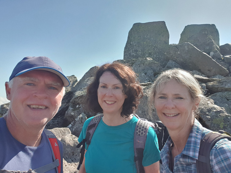
A good weather forecast was given on a sunny August Bank Holiday. Today we were joined by my sister Sheila who also enjoys a challenging walk. We first visited the cafe/toilet area at Llyn Ogwen. There is a pay car park here but by 9am it was full. Having visited previously we know parking has never been an issue with plenty of small areas along the lake. We carried on driving in the direction of Capel Curig keeping the lake to our left, and at 9.15am parked for free in a lay-by where we could see a stile going over the wall- this is a good reference point for the start of the walk. It was a perfect day with reflections of the mountains in the lake. It was fairly busy, and lovely to see so many people out. Steep paths seem to leave all the lakeside parking areas, then after a while merge together becoming a very steep rocky path, with cairns or people to follow. Picking over rocks it is quite slow going, as the whole day would be. We were following the North Ridge, and after about an hour came across the famous Cannon stone, which is a challenge to sit or stand on, and can make for an impressive picture with the valley as a backdrop.
We carried on taking a path on the left, which ended in a gulley with some rock climbing required. Eventually the top came into view, and we followed the most direct route up the ridge. We made it to the summit 2 and a half hours after leaving the car. It had been an exhilarating walk, with fantastic views over the mountains, to the Menai Straits and Anglesey in the distance, the cloud was rolling in from the sea but did not reach us. On the summit of Tryfan are two upright stones, christened Adam and Eve, the challenge is to jump from one to other. This feat is definitely not for us, but always exciting to watch other people, but very scary as if you miss, it is a long drop down. If driving along the A5 from Cable Curig towards Ogwen, the 2 stones can clearly be seen. Unfortunately there were lots of small flies at the summit, so we started the rocky descent towards the Glyders. The path is rocky and sometimes not easy to follow. We ate our lunch at 12.15pm overlooking a stile and a path up the Glyders. If the weather is bad or you have had enough there is an obvious path to the right back down to the main car park, where the cafe is found.
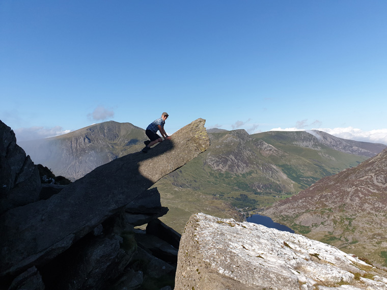
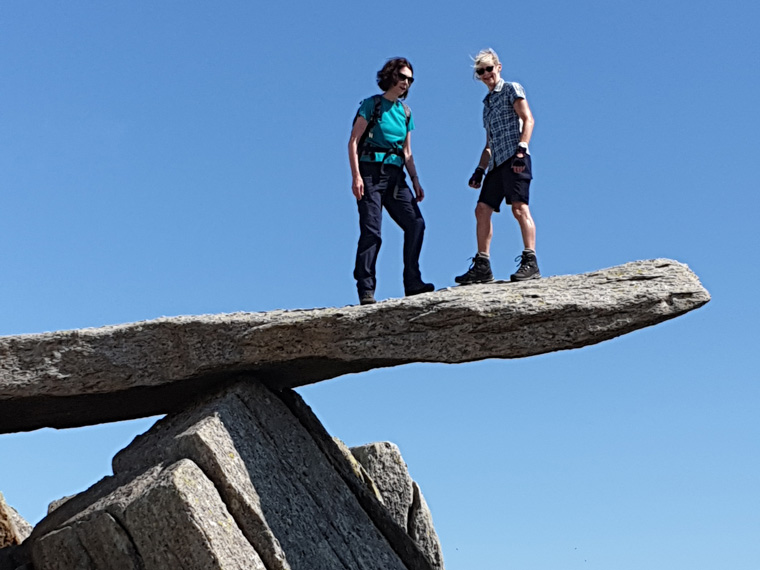
From this point if continuing over the Glyders there is a choice of routes, one to the left of the wall up the steep scree slope, or to the right up Bristly Ridge. The latter involves a great deal of rock climbing, I have been this way many years ago, but more recently completely lost the unmarked path. So we decided the scree slope was the more sensible option. The climb up the screes took us 40 minutes and we eventually reached the top of Glyder Fach. Strolling ahead over the very rocky terrain, another famous landmark came into view - the Cantilever stone, which is another great photo location. The challenge is to see if you can stand on the far end,
a test of nerves.
Carrying on past 'Castle of the Wind' a strange configuration of splintered rocks, we reached the final Glyder at 3pm, and celebrated with a small bottle of red wine and chocolate. Be careful in this area not to take the wrong turn as the path is not easily found, especially in poor weather. We continued heading northwards down a sometimes dangerous scree slope to a lake at the top of the Devils Kitchen, so called as the mists sometimes rise as if from a devil's cauldron, at 4pm. We had covered just 4 miles all day, mostly over very difficult rocky terrain, which makes it slow going. At this point, sometimes we have carried on up Y Garn and back to Llyn Ogwen. However, as we were returning to Manchester and did not have time, we decided to go directly down the Devils Kitchen, with fantastic views over the Llyn Ogwen valley. Half way down the path splits to go around the tarn-Llyn Idwal, either way is fine. We took the route to the right, and were surprised to see a new bridge had been built over a fast flowing stream, this can only be good, thereby making the path more accessible. By 5pm we reached the end of Llyn Idwal and followed the very obvious path to the right, which was very busy with tourists. We returned to the cafe at 5.30pm and sat by the lake with a well deserved coffee, before returning to the car at 6pm.
Comments
This was an extremely enjoyable day, with some challenging walking involved. If you need a comparison this is the closest terrain to the GR20 in Corsica that we have found in the UK. The walk tests the whole body, with some climbing involved, some steep drops, and rocky terrain and at times a good head for heights. And yes we were unable to summit Tryfan on our route without using our hands. We had beautiful weather, great views, and met some lovely people. Previously we and others have been lost in thick fog on the top of the Glyders. Some cairns are located on the tops, but not enough. Take care on Tryfan in wet/snowy weather, the rocks would become very slippery and dangerous. It is an area to avoid in winter without the correct equipment. As always we advise wearing walking boots, taking food, water, wet weather clothes, hats, sun hats, map, compass, whistle, mobile phone charger and first aid kit etc.
Distance covered 7.14 miles (11.49km)
Duration of Walk Hours 8.50
Average Pace Hours/Mile 1.14
Steps 41147
Elevation gained 2972 feet (905m)
Books used
Collins Ramblers Guide North Wales by Richard Sale
Snowdonia Walks from the Carneddau to Cadair Idris by Jerry Rawson
Great Mountain Days in Snowdonia by Terry Marsh
Ordnance Survey map of Snowdonia
Websites Used https://www.mapmywalk.com/ http://www.mwis.org.uk/ https://www.bbc.co.uk/weather