


Alhaurin de La Torre to Benalmadena, Malaga, Andalucía, Southern Spain
This walk near Malaga, Southern Spain follows part of the GR249 from Alhaurin de La Torre to Benalmadena. We had flown over from our home in Manchester to Malaga for some winter sunshine for a couple of weeks. We were staying in Torremolinos where we have stayed many times before. There are many walks in the vicinity, as well as fantastic beaches and restaurants. Transport links are good, with a regular, cheap bus service to Malaga.
We were staying in Torremolinos and caught bus number 110 in the direction of Malaga, alighting at the stop after IKEA, crossing the bridge over the main road, then changing to catch bus number 132, arriving in Alhaurin de la Torre an hour after setting out. We had a walk round Alhaurin and a coffee in Cafe and Pastel restaurant in the main square of Plaza de San Sebastian. This is typical Spain, with plenty of people out with lots of chatter, sitting outside the cafe. The weather looked mixed, maybe sun, maybe rain, we had our shorts on and hats etc with us. On this walk there are no amenities, so provisions had been bought in Mercadona supermarket the night before and sandwiches made.
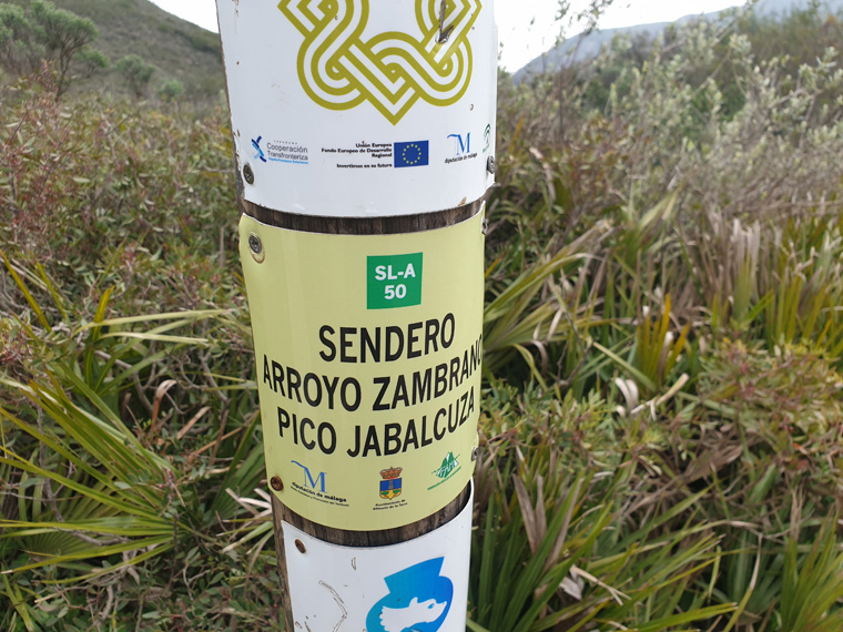
We walked up the hill over the road to Parque Juan Pablo, passing apartmentos Santa Clara, left along Calle Peteneras, then Calle Pablo Milanes, then right following the road steeply upwards past large houses. The path officially begins at the Gr249 sign found here at the end of the road, together with an information board about Monte Jabalcuza, and a sign for Benalmadena 11.7km, with parking in a lay by. We set out from here at 11.45am, the path was very quiet. We followed the well trodden stony path between the olive trees, crossing dried up river beds, listening to plenty of birdsong. Sunny with a breeze.
We continued along a clear path for another 30 minutes until we arrived at a disused aerial lift from a quarry. In this area there are about 6 huge quarries, we presumed from the main building works along the Costa over the last 40/50 years. The area is now quiet with the quarries closed and the big cranes all gone, partly due to the crisis ten years ago, when most building works were suspended.
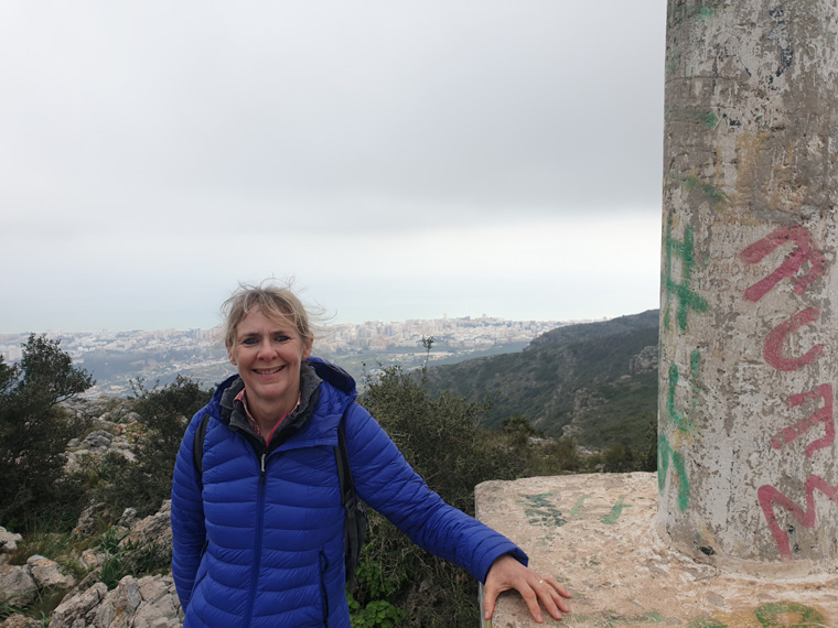
We followed a path which keeps close to the spine of the ridge. We arrived at the new Refugio del Canada, shortly followed by Albergue del Canada, both of which were shut. We presumed they have been built for walkers on the GR249, to avoid finding accommodation in Torremolinos or Benalmadena about 500m down the mountain. We would like to visit during the summer when they are open. The weather when we started out had been sunny and windy. But by now the wind had really picked up, the whole of the coast now obliterated by mist. At this point we had our coats, winter hats, and gloves on, and regretted wearing shorts.
We followed the Route 1 down, eventually it splits we followed the Route 2 back over the motorway. This is a fairly straight forward path taking about an hour from the top ridge to the motorway. From here we walked past some new build properties, we could have walked another hour down to the coast where we were staying, but opted to catch the bus number 121 instead at 4pm. Then had a lovely walk along by the sea instead of walking through Arroyo de Miel.
Distance miles (6.84 Miles - 11.km)
Duration of Walk Hours 4.35 Hours
Average Pace Min/Mile 36.46
Steps 25,292
Elevation Gained feet (675m)
Information/Advice
As usual wear boots, take a phone, take sun hats, sun tan lotion and plenty of food and water as after leaving the start there is no-where to replenish supplies. It can also be chilly on the top (as we found), especially if windy or the clouds roll in, so take a wind proof jacket and hat. I would advise taking a compass too in case you lose your way. Being located in southern Spain, I would advise not doing this walk in the summer months as it would be far too hot, and would require carrying too much water.
Check the weather forecast before setting off, as it would be a shame to walk all this way and have no view. This area of Southern Spain is accessible from England either by driving through France and Spain, or flying to Malaga then hiring a car or catching the reliable, cheap public transport.
Websites used
http://www.andalucia.com/mijas/bus-services.htm
Resources used
Coastal Walks in Andalucía by Guy Hunter-Watts, Cicerone Press. Walk 26. We followed the first part of Walk 26 Alhaurin de la Torre Southern circuit. It is useful to have the book to refer to, but the walk is signposted all the way.
Part of the walk is on the GR249, which can be printed out or accessed by phone.
We looked in bookshops in Malaga for any maps of the area, but could not find any. If anyone knows where to get a map from, please contact us.