


Capileira, Las Alpujarras, Southern Spain
This is a short circular walk from the beautiful village of Capileira, one of the highest villages in the area at 1432m. The walk provides great views of the Poqueira valley and the surrounding mountains. It is a short introductory walk to the Las Alpujarra area. We had driven here from where we were staying in Malaga and checked into Hostel Rural Las Terrazas de la Alpujarra in the small village of Bubion for 4 nights.
We parked on the very full free car park in the middle of the village at 1.45pm. I would imagine that this village would always be busy, as it is so pretty, but more so due to it being Sunday lunchtime. From the centre of the village, we headed past Bar El Tilo, along the paved road, and walked past 2 Eras, along a cobbled road, then followed a sign for Camino De Abuchite. An Era is an area with a flat stone floor, which is used for threshing wheat, and is usually circular. We have seen many on our walks all over Southern Spain. The path descends into a valley, then after 10 minutes we forked left following white and yellow markers, reaching a bridge over the river at 2.15pm.
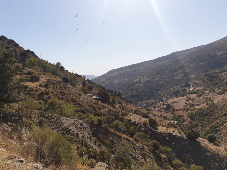
We sat enjoying the peace and quiet of the river and ate our lunch. We crossed the river, climbing gradually, now tracking north along the easy path, which runs parallel to the river. We passed an old ruin and another Era. It was a hot afternoon, for mid-October, fortunately some shade was provided by the trees. We passed a couple more run-down farms before arriving at a bridge crossing the River Poqueira. This is as far up the valley that this walk goes. We walked round the corner at this point just to look at the buildings of an old HEP power station, before turning round. There is a route here to a refuge that people stay in if approaching mainland Spain's highest mountain Mulhacen from this direction. We met a group who had just accomplished the climb, looking worn out.
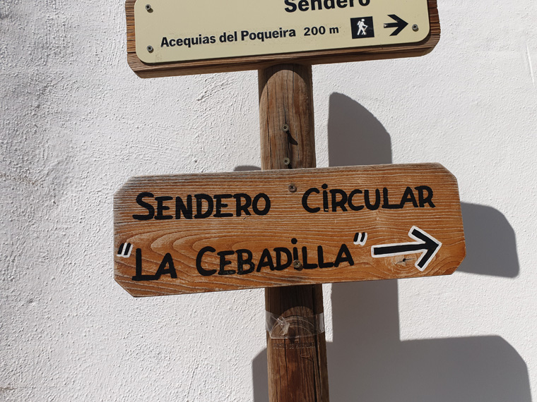
Returning to Capileira on the other side of the valley to where we had walked up, we walked through the now deserted village of La Cebadilla. This is where the workers of the power station once lived, it is a shame to see the buildings falling into disrepair. After passing under electricity pylons, and a sign saying Capileira 2km we branched right. The path continues in the same southerly direction, along tracks, with some marker posts, passing 2 white huts. We had stunning views over the village of Capileira and Bubion where we were staying. We arrived back in the village at 4.45pm after a leisurely walk. It is a very pretty walk, our first one away from the traffic on the Costas. As usual on our many walks in Spain, we didn't meet many people.
Distance 6 miles (9.65km)
Duration of Walk 3.15 Hours
Average Pace 31 Min/Mile
Steps 18628
Elevation Gained 1804 feet (550m)
Information/Advice
As usual wear boots, take a phone, take sun hats, sun tan lotion and plenty of food and water as after leaving the start there is nowhere to replenish supplies.
Check the weather forecast before setting off.
This area of Southern Spain is accessible from England either by driving through France and Spain, or flying to Malaga then hiring a car or catching the reliable, cheap public transport or the route that we took driving from our home in Manchester then catching the 24 hour relaxing ferry from Plymouth to Santander, then touring through Spain.
Resources Used
Walking in Andalucía by Guy Hunter-Watts Walk 26 Cicerone press
Andalucía and the Costa Del Sol by John and Christine Oldfield Walk 23 Sunflower Press
Websites used
https://www.mapmywalk.com/
https://www.bbc.co.uk/weather
https://www.expedia.co.uk/Bubion-Hotels-Hostal-Las-Terrazas-De-La-Alpujarra.h35602370.Hotel-Information where we stayed
http://www.andalucia.com/