


Ferreirola Northern Circuit/or seven ancient villages, Las Alpujarras, Southern Spain
This is a walk that we completed 2 years ago, but thought it so lovely and interesting that we returned to walk it again. The walk follows ancient tracks linking 7 villages of an area called La Taha, with a small amount of road walking. It is fantastic to think the paths have been walked by 1000's of people over at least 1000 years. The villages once occupied by the Moors have a North African appearance, with flat roofs huddled together on steep valley sides. One interesting feature are platforms or the Tinaos over the alleys, which enable rooms to be built above. We met an English couple whose house is 900 years old.
Las Alpujarras is an area situated in the Sierra Nevada in Andalucía between Granada and the Mediterranean Sea. We had driven here from where we were staying in Malaga and checked into Hostel Rural Las Terrazas de la Alpujarra in the small village of Bubion for 4 nights. The area is very popular with walkers, has beautiful scenery, good value accommodation and food. It can be reached by car, or by public bus from Nerja or Granada.
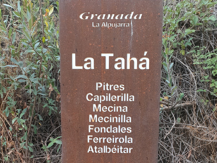
We parked at the side of road A7210, in Pitres, and walked towards bar La Meta. The walk signposted Camino de Mecina, runs steeply down past the side of the bar, it is concrete at first, then narrows to be a footpath with cobbles, worn down in a deep channel by the tramping of many 1000's of feet. After about 20 minutes we passed by an old Era, the first of many, minutes after the first village-Mecina-is reached. An Era is an area with a flat stone floor, which used to be used for threshing wheat, and usually circular. We have seen many on our walks all over Southern Spain. Take some time to wander around all of the villages, they are all slightly different from each other and all fascinating, a lot of the houses are 100's of years old. We wound our way down through the village, finding the road out of town by the old wash house, carrying straight on down the road passing a cafe and the auberge on the left, arriving in Mecenilla shortly afterwards.
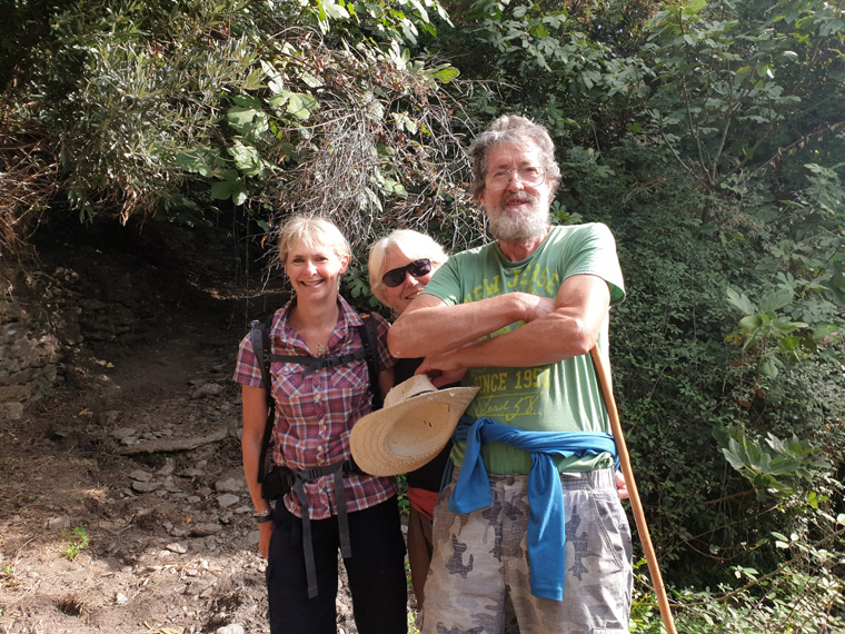
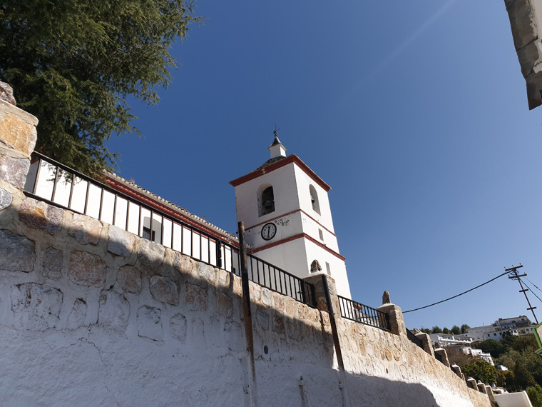
Cutting down again, we passed the church, then followed the signs, Camino de Fondales. Fondales is another pretty whitewashed village, we went straight down through the village under the arches of the houses to a path by some fig trees. Turning left at house Number 9 we followed the path to another beautiful village-Ferreirola. We met an English couple from Kent-Sheileigh and Conor-who have lived here for at least 20 years. We walked with them for a while as they recounted the history of the area, including the Moors being driven out of this part of Spain on 2nd January 1492 by Ferdinand and Isabella. Gerald Brenan the author also used to live in the village.
We continued uphill, past a wall on the left to join a track, continuing straight on, eventually turning right along the main road (A7210) towards Busquistar. We walked all round Busquistar searching for the cafe near the church where we had had a delicious lunch last time we were here. But we concluded as there was no sign outside it, it must have shut down. We had coffee in Bar Vegas instead-no food sold-and ate our sandwiches that we had prepared earlier on a bench with fantastic views over the valley and 3 more Eras. There is a Coviran supermarket and small village store here. The walk in the book (Walking in Andalucía) now joins the GR7 in the direction of Trevelez. We opted not to do this and cut the corner instead.
We turned back down the street, passing house number 5 on Calle Rosario, taking a track past houses and dogs. The path then tracks across the countryside, with great views to the mountains to the south, passing another Era together with an information board. Eventually we arrived in the final village for today of Pitres. After taking our time to look at the Town Hall in the main Square, with a beautiful tiled frieze, we went for a coffee at a cafe on the square. Then followed the road back to our car. A thoroughly enjoyable day, more relaxing than most of our walks.
Distance 7.38 miles (11.87km)
Duration of Walk Hours 5.11
Average Pace 42.12 Min/Mile
Steps 27489
Elevation Gained 1417 feet (431m)
Advice/Information
We cut the corner on this walk, skipping the GR7 towards Trevelez. We could then take our time looking round the villages properly. One of the walk's highlights was the Portugas Fuente Agria on the A7210, which I would really recommend visiting, it is quite unlike anything which we have seen. We would have missed this if we had taken the GR7. Even if just out for a drive in the area, ensure that you visit this and maybe some of the villages. There are many more walks up and down the valley that have been recommended to us.
As usual wear boots, take a phone, take sun hats, sun tan lotion and food and water, just in case you don't find any en-route. When we walked in mid-October the paths were very quiet. The weather was slightly overcast, cloudy and some rain was predicted but did not materialise. The following week there was a very large snowfall.
Check the weather forecast before setting off.
We would recommend staying at the Hostel Las Terrazas in Bubion, having stayed here previously. The hotel has a lovely Spanish feel, the owners are very friendly Spanish speakers, a nice breakfast is served,(which can be paid for separately) lots of walking routes have been printed out, and the owners will photocopy these for you, as well as being good value for money. Bubion is a beautiful village, typical of the area, with a couple of restaurants and very small Coviran shop.
This area of Southern Spain is accessible from England either by driving through France and Spain, or flying to Malaga then hiring a car or catching the reliable, cheap public transport or the route that we took driving from our home in Manchester, catching the 24 hour relaxing ferry from Plymouth to Santander, then touring through Spain.
Resources Used
Walking in Andalucía by Guy Hunter-Watts Walk 29 Cicerone press.
We actually started the walk in Pitres instead of Ferreirola as the book does. Because driving from where we were staying in Bubion it is the first access point to the walk, and being circular it does not make any difference.
Websites used
https://www.mapmywalk.com/
https://www.bbc.co.uk/weather
https://www.tripadvisor.co.uk/Attraction_Review-g1918406-d12884509-Reviews-Fuente_Agria-Portugos_Province_of_Granada_Andalucia.html orange fountains
https://www.expedia.co.uk/Bubion-Hotels-Hostal-Las-Terrazas-De-La-Alpujarra.h35602370.Hotel-Information where we stayed
https://www.tripadvisor.co.uk/Restaurant_Review-g1047553-d8374587-Reviews-Artesa-Bubion_Province_of_Granada_Andalucia.html restaurant where we ate
https://treksierranevada.com/information-centres#capileira information centre
https://www.alsa.com/en/web/bus/home bus
http://www.andalucia.com/