


Mijas circuit, near Malaga, Andalucía, Southern Spain
Mijas is a superb typical Andalucian white washed village which deserves a visit in its own right. We were staying for a few weeks in Benalmadena where we have stayed many times before. Today we had been joined by my sister Sheila and niece Iona who had flown out for a week. There are many walks in the vicinity, as well as fantastic beaches and restaurants. Transport links are good, with a regular bus service to Mijas and Malaga. Having driven to Spain from our home in England, we drove the short 30 minutes to Mijas, alternatively regular buses run from the coast, Malaga and Fuengirola.
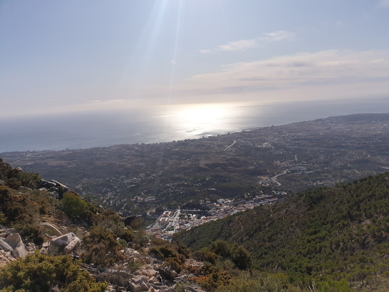
The walk can begin from the multi storey car park or street parking in Mijas. However, as it was a quiet November day we were able to park at 10am at the Mirador de Mijas, with beautiful views along the coast. From this point there are various options for walking, some more clearly signed than others, we chose a circular walk of 14km via the Pico de Mijas.
The weather was slightly chilly, and for a change we wore walking trousers instead of shorts. Turning right from the viewpoint we walked for about 100 meters to where the walk commences by a detailed information board showing various walks. We followed the path for 20 minutes and reached a beautiful whitewashed hermitage church, looking lovely with a cloudless blue sky. We found the path after this rather confusing with various routes leading off it, concentration is required to find the way. But we headed uphill following signs for the Sendero Puerto Malaga, along the zigzag path with some blue spots to follow. After 2 hours of walking we went left at the sign saying The Picos de Mijas 1 hr 15 mins.
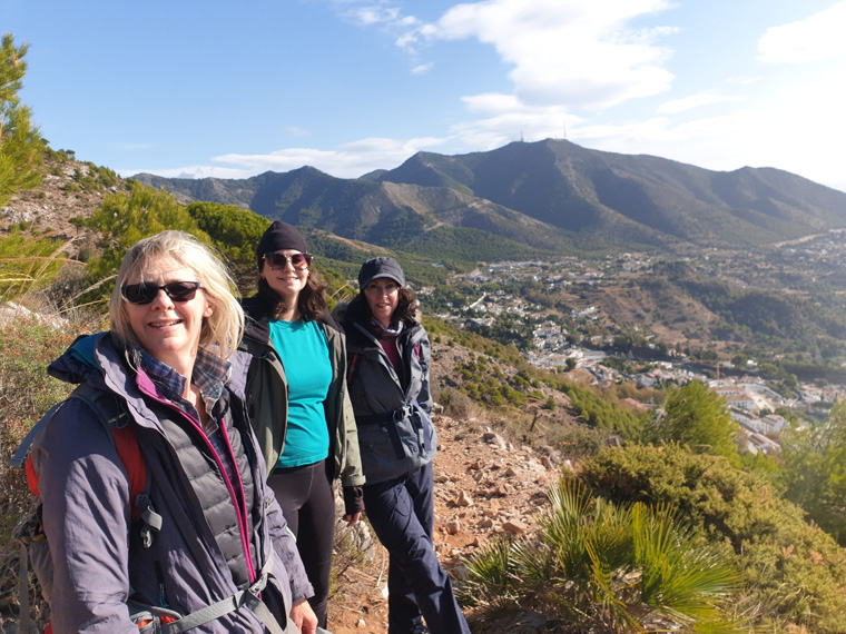
The path swings to the left, with brilliant views towards Gibraltar, then descends, before turning north. At an orange-tipped marker post we turned right, heading for the ridge. On the ridge is a hut - not sure what for-and an information board, then on reaching a 4-way junction, we turned sharp left up a steep slope. The top of the mountain is so close with golf ball and television antennae . We summated at 1pm, taking 3 hours from the car, after getting lost a few times.
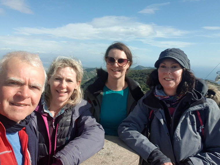
We were so happy to be there, sitting eating our lunch with tremendous views in all directions- to Africa, Gibraltar, Malaga and the mountains behind and all of the coast. We imagined what it would have looked like 50 years ago without all the development and motorway. It had been well worth the climb, with sublime views. The walk had been very quiet, we met the first other walkers of the day near the top, and some cyclists who had arrived from Alhaurin.
We carried on the circular walk leaving the top at 1.45pm to get out of the wind. Returning down to the 4-way junction, back down the path we came up. Not taking the first path on the left by a wall, taking the 2nd path to the right which is not signed. Continuing to take care on the uneven ground. At 3pm we angled left following orange markers. The path wound down through the beautiful pine trees looking resplendent with the blue skies. Through the trees, across a dried-up valley re- joining the white and red signs. By 4pm we were now on the GR249 signposted to Mijas 3.5km. Then continuing downwards we eventually came to a disused quarry. As it was getting a bit late by now, we stopped following the path and instead cut to the right. On reaching the road, turned left to follow it back to the car arriving at 5pm. This whole walk had taken longer than we had anticipated. But we would recommend this walk, with beautiful empty countryside, and the views make it all worthwhile.
We then went for a walk around Mijas. There are many tourist shops, a couple of supermarkets, small museum, bull ring, restaurants with both good value menus (3 course for €9 ) or more expensive ones. The views up and down the coast can be sublime. As I say well worth a visit. We ate dinner on the main square, nice food and good value for money. As it was November as soon as night fell it was extremely chilly, remember as well Mijas is at 1500 feet (430m) above sea level.
Distance 9.22 miles (14.8km)
Duration of Walk 7.13 Hours
Average Pace Min/Mile 47
Steps 37137
Elevation Gained 3006feet (916m)
Information/Advice
As usual wear boots, take a phone, take sun hats, sun tan lotion and plenty of food and water as after leaving the start there is no-where to replenish supplies. Try to go with others, leave early in the morning to avoid the heat, and so parking is not a problem. It can also be chilly on the top, especially if windy or the clouds roll in, so take a wind proof jacket and hat. I would advise taking a compass too, as it is easy to lose your way.
Being located in southern Spain, I would advise not doing this walk in the summer months as it would be far too hot, and would require carrying too much water.
Check the weather forecast before setting off, as it would be a shame to walk all this way and have no view. We have been to the top once before, again with fantastic views.
This area of Southern Spain is accessible from England either by driving through France and Spain, or flying to Malaga then hiring a car or catching the reliable, cheap public transport or the route that we took driving from our home in Manchester then catching the 24 hour relaxing ferry from Plymouth to Santander, then touring through Spain.
Resources Used
Coastal Walks in Andalucía by Guy Hunter-Davies Walk 22 Cicerone press
Websites used
http://www.andalucia.com/mijas/bus-services.htm