


Mijas to Benalmadena, Malaga, Andalucía, Southern Spain
This walk near Malaga, Southern Spain, follows the GR249 from Mijas to Benalmadena. Mijas is a superb typical Andalucian white washed village which deserves a visit in its own right. We were staying for a few weeks in Torremolinos where we have stayed many times before. There are many walks in the vicinity, as well as fantastic beaches and restaurants. Transport links are good, with a regular bus service to Mijas and Malaga.
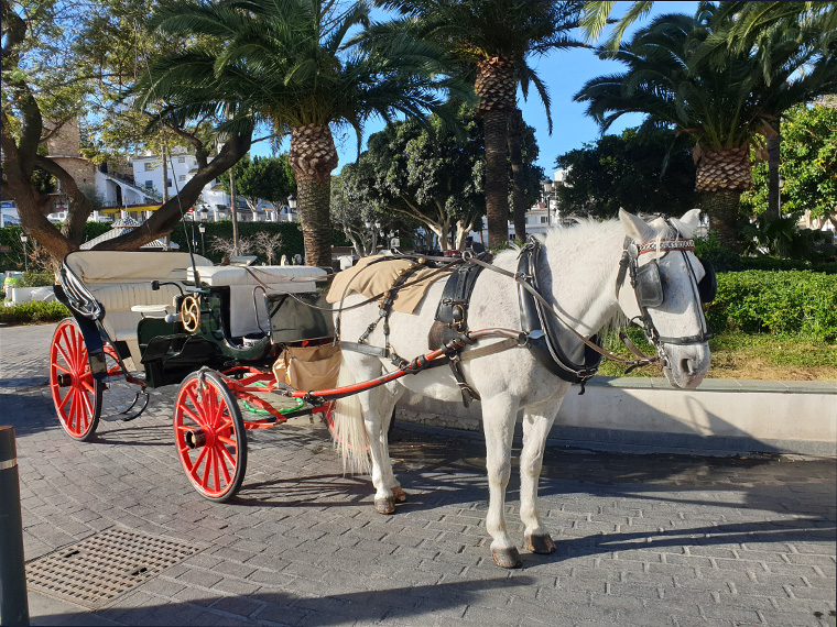
We caught the bus number 121 from where we were staying in Torremolinos at 9am, to Mijas Pueblo, arriving 50 minutes later in the main square. Mijas being close to the coast is a real tourist hotspot. There are public toilets in the main square next to the tourist information from where we obtained very useful free maps from an English speaking assistant. In Mijas there is a multitude of cafes/restaurants and a couple of supermarkets. On this walk there is nowhere to purchase any supplies so we had brought sandwiches, food and water with us.
We set out from the main square at 10.10am,taking the steps at the side of Bar Gonzalez and going straight on over the road, following the walkway up to the main road, before turning left for 150m. We crossed over the road to a very useful information board with many local walks displayed, and a sign to our destination Benalmadena 17km along the GR249. After ten minutes of walking we reached the very beautiful Hermitage built in 1792, we have been here on a few occasions and it is always locked. If in Mijas make sure you walk here even if nowhere else. The views up and down the coast are stupendous. We re-traced our steps for about 50m then followed the red and white signs uphill, leaving here at 10.30am.
After 25 minutes we turned right following the red and white signs and a blue sign on a post. Ten minutes later at a sign for Sendero Puerto Malaga we again followed the red and white, continuing uphill and on reaching a road we turned right. We followed the relatively level track round the corner, turning right signposted Benalmadena, passing a quarry to the right, many beautiful trees, then through a disused gate.
After 40 minutes of walking, the track opens up in a clearing with various routes off it. We turned right up a wider track heading slightly uphill. We passed through a gate down concrete steps, missed the sign and went straight on along a narrow path. After about 200m we saw the error of our ways, as we were on the top of a very steep drop directly above a disused quarry!!! Very scary. Given how well worn this path is, we realised a lot of people had taken the wrong way. We very carefully retraced the path back to the concrete steps and saw the sharp left turn we should have taken. Be very careful at this point not to make our scary mistake. Ten minutes later we arrived at a road unusually with no sign. We chose the uphill route, but after about ten minutes realised this must be wrong and turned round following the road back down hill. Eventually we saw a sign saying right to Benalmadena 10.6 km.
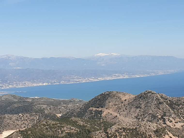
Another 10 minutes brought us to a clearing with more amazing views, on one side was the sea, another way views of all the countryside behind Malaga, and in the far distance snow on the mountains behind Nerja and ahead of us a hill with many television towers on. At 12.50pm we sat on chopped down tree trunks and ate our lunch. We continued along the mostly well sign-posted rocky path, through trees, with intermittent views. After a further 90 minutes at 2.10pm we reached the road to the towers. Here there is a choice to follow the road or continue along the path, we are not sure which was quicker but we followed the path. At 2.30pm we reached the road again and followed it up the final couple of metres to the top.
After 4 hours of walking including breaks, we reached the highest point of the walk, by the television towers, which are a landmark for miles around.
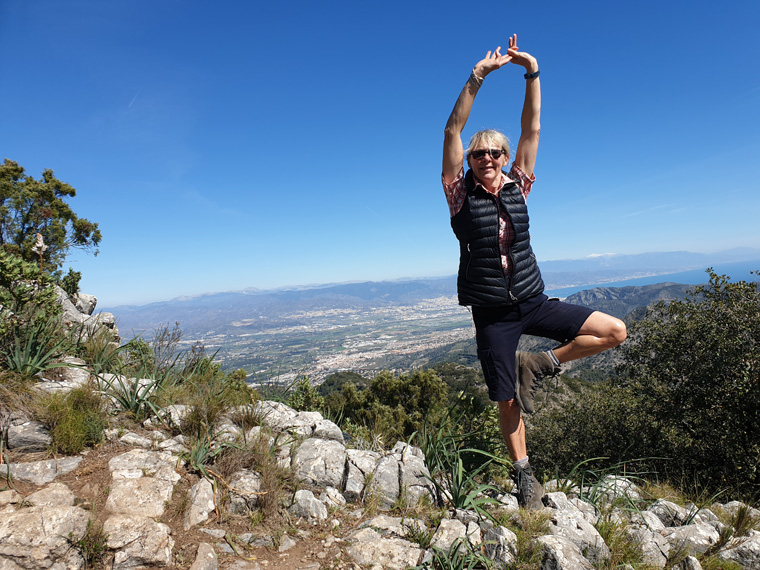
The weather was fantastic, windy and sunny, so different to a cold February day back in England. We were treated to some of the best views we have ever had, stretching all the way along the coast to Gibraltar, and a large part of North Africa. We have been previously walking in Spain in January and February and found the views excellent, maybe due to the colder air.
Slightly retracing our steps, to the right there is a concrete bench and an information board with details of all the walking routes above Benalmadena and Torremolinos. We took the path in an easterly direction, the gently undulating route being quite easy to follow, with sandy or rocky terrain.
After 30 minutes we came to a sign for Benalmadena 3.4 km down Route 3 following the Gr249 path that we had taken for most of the day, which we took. The path was not straight down as we had imagined, but with various uphill stages. It was tough going underfoot, only improving slightly after we had crossed over a dried up river bed, and passed several concrete huts. After an hour we reached some more signs for R3 or R4. We turned in a westerly direction parallel to the motorway on our left. After another 15 minutes we turned left under the motorway arriving at the end of our walk in Benalmadena Pueblo. Here there is a board with routes back up the mountain. We followed the road downhill, until reaching a large veterinary practice, we turned left and found our bus stop back to Torremolinos.
We were disappointed with this route down, finding it harder work than we had expected, even though it is a pretty path through the trees. But another time we would carry on along the ridge and come down Routes 1 or 2 instead, as on our walk from Alhaurin de la Torre to Benalmadena.
Also we did not like the long dark tunnel under the motorway, and biting insects found here by the river. But the advantage of this route is you could have turned right on the main road by the vets practice and walked the short distance into Benalmadena Pueblo. This white washed village is definitely worth a visit in its own right, similar to Mijas with small pedestrianised streets, a stunning viewpoint and many bars and restaurants. The bus also leaves from here to Torremolinos and Malaga.
We have previously walked this route in the opposite direction from Arroyo de La Miel to Mijas. On that occasion when arriving at the television towers we followed the walk down the road and after about 5 miles met the main road into Mijas. The GR 247 definitely takes a longer time. But even though the views from the road are great, the ones from the GR are definitely so much more spectacular.
This is a walk that we would recommend, with superb views. However, it is a long day with no supplies available. I would recommend doing this walk in the cooler months like we did- February, and maybe leaving earlier than we did if possible.
The GR249 is a roughly circular route running around the province of Malaga, 650km over 35 stages. Maybe a thought for us for a future walk. The majority of the path is well signposted, with posts with red and white stripes, or slashes of red and white on the rocks. They are usually found at regular intervals, so if none have been seen for a while, maybe it is a good idea to make sure that you are still heading the correct way.
Distance 11.185 miles (18km)
Duration of Walk 7.50 Hours including breaks
Elevation Gained 2395 feet (730m)
Elevation Lost 3280 feet (1000M)
Information/Advice
As usual wear boots, take a phone, take sun hats, sun tan lotion and plenty of food and water as after leaving the start there is nowhere to replenish supplies. It can also be chilly on the top, especially if windy or the clouds roll in, so take a wind proof jacket ,hat and gloves. I would advise taking a compass too in case you lose your way. This walk took us considerably longer than the estimated time given on line of 6 hours 15 minutes, so try to leave early, then relax and enjoy it as you go.
Being located in southern Spain, I would advise not doing this walk in the summer months as it would be far too hot, and would require carrying too much water.
Check the weather forecast before setting off, as it would be a shame to walk all this way and have no view. This area of Southern Spain is accessible from England either by driving through France and Spain, or flying to Malaga then hiring a car or catching the reliable, cheap public transport.
Websites used
http://www.andalucia.com/mijas/bus-services.htm
http://www.gransendademalaga.es/en/
http://www.gransendademalaga.es/en/etapas/lis_cd-6637/gr-249-etapa-33-mijas-benalmadena
Resources used
Walking Coastal Walks in Andalucía by Guy Hunter-Watts, Cicerone Press. We followed the first part of Walk 23 Mijas Circuit. The last third of the walk is the opposite way down Walk 27, Benalmadena circuit. The middle section of the walk not being in the book. It is useful to have the book to refer to, with some maps in, but the walk is signposted most of the way.
The walk is on the GR249, sections of which can be printed out or accessed by phone.
We looked in bookshops in Malaga for any maps of the area, but could not find any. If anyone knows where to get a map from, please contact us.