


Treviso, Picos de Europa, Northern Spain
The remote mountain village of Treviso until a few years ago was accessible only by a path built by engineers in the19th century to access the mines. The maximum gradient is 30°for the ox-carts pulling ore downhill. The villagers used to roll the cheese down the hill every Monday to market and the postman walked the 825m uphill to arrive with the letters. These days the village has been connected to Sotres by road. However it remains a stunning walk with stupendous views and in parts a vertiginous path - not for the faint hearted. We had walked this on our previous Picos visit so knew what to expect.
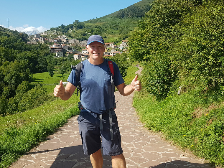
We were holidaying in the Picos area of Northern Spain, staying at The Hotel La Rivera, Arenas de Cabrales. Unfortunately for us breakfast was served from 8.30am, but having decided to leave earlier than this, once again missed the breakfast and we went to Santelmo cafe, down the road, for coffee and toast €6 for 2. It is a 45 minute drive to the start of today's walk at Urdon. Taking the main road to Panes, we made a quick stop at the small Coviran supermarket. This is a small town with lots of hardware shops, tourist shops, restaurants and bars. Continuing along the main road towards Potes, we parked at Urdon, which is 2 km north of La Hermida. Parking is limited, so try to arrive early, there is a small car park with a useful map of the walk on the right hand side of the road, or parking is found in lay-bys on both sides of the road. Alternatively park in La Hermida and walk along a path just above the road which joins the walk in Urdon.
We parked at the side of the road at 9.45am with 20 other cars already there. Leaving the car park by the pretty river valley, up past the side of the power station, the route then follows the first of a series of zig zags. We passed through a closed gate on the path at 10.30am, rounding the corner at 10.45 with great views up the valley. This point is the first of many steep drops, be careful not to trip!!!
The zig zag path is easy to follow, just the heat and incline making it hard work. As it got hotter and steeper, we and others stopped to rest under the shade of the occasional tree found along the way. The fellow walkers were all friendly, a lot were accompanied by sure footed dogs.
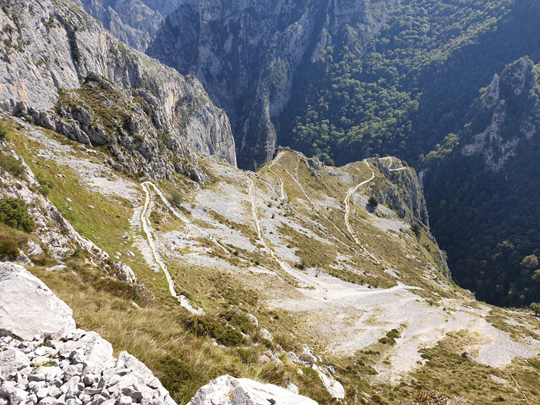
We stopped a lot to take in the brilliant views down the valley, imagining what the path looks like from the other side of the valley. Looking down on the path, it does look very steep. By 12pm we reached the top row of pylons, and the view back to the zig zags vanish. A flatter path then starts with pylons on right, followed by the 3rd set of zig zags up to the village.
Watch out for the vultures living on cliffs, we stood for a while to watch their great aeronautical displays, which they seemed to be doing just for our benefit. There is a spring by a disused building if desperate for water. At 12.30pm we reached the village path with a gloriously placed picnic bench, with views to the village and down the valley.
The village itself is very pretty, most houses seem to have undergone a recent make over. Most walkers appear to make for the only bar where there is seating inside and out and a restaurant. Food is sold, as well as their very famous local cheeses. We arrived at the bar at 12.35 pm, the walk taking us nearly 3 hours, but with plenty of rests. We ordered a small beer, coke and coffee costing €5.50. We took the opportunity to rest in the shade, and chat to fellow walkers. We had as usual taken our own picnic, very conveniently there are lots of picnic benches by the church in the shade, which were all empty.
The only route back to the car is to take the same path. But it is certainly a lot easier descending with great views all the way, and again accompanied by vultures, and the occasional eagle. It took us one hour to reach the view point with pylons, back at the gate on the path at 3pm and arrived back at the car at 3.40pm.
At the parking area there are no facilities, but if you fancied refreshments, drive, or walk the 2km to La Hermida. This is a pretty village with parking and lots of pretty restaurants.
Previously we undertook this walk on a mid-week October day. On that occasion we were the only car parked, the only people saw were engineers fixing the pylons along the path, and we were the only people in the village bar. On this occasion there were a lot more people, which added to the day.
Distance 9.6 miles (15.5km)
Duration of Walk Hours 6.06
Average Pace Min/Mile 38.05
Steps 33336
Elevation gained 3444feet (1049m)
Information/Advice
As usual we wore boots, took sun hats, sun tan lotion, food and plenty of water.
I would recommend this walk if you not afraid of heights. Start out early to avoid the heat of the day, there is little shade and not an abundance of parking. The walk of 1049m, 15.5 km, took us nearly 3 hours, but we were taking it easy, enjoying the views and had a drink and lunch in the village. I found it fascinating walking a historic path, imagining the carts and villagers using it before the road arrived.
Be aware of vertiginous drops at points, so complete the walk if you are not scared of heights, and mind children/pets carefully.
Don't attempt in snowy/icy weather, one false slip and you could be over the edge.
Parking is probably an issue during the summer months and at weekends, so arrive early to get a space.
This area of Northern Spain is accessible from England either by driving through France, or flying to Bilbao, then hiring a car or the route that we took, driving from our home in Manchester then catching the 24 hour relaxing ferry from Plymouth to Santander. From Santander we visited Aldi in Torrelavega as the food is more expensive in the Picos national park area, and drove to where we were staying in La Rivera Arenas de Cabrales for 5 days.
Resources/ Used
Picos De Europa car tours and walks, by Teresa Farino Sunflower Press
Picos de Europa Map scale 1:80.000
Spanish Trails, Book 1, Los Picos De Europa by Phil Lawler, was recommended by fellow walkers.
Another book is Picos de Europa et sur la cote Cantabrique, by Alban Boyer. This is in French, but with maps in and accurate timings, you could get the gist even without knowledge of the language.
Websites
https://www.mapmywalk.com/
https://www.bbc.co.uk/weather
https://la-rivera-es.book.direct/en-gb
https://www.brittany-ferries.co.uk/